Kell, Kev and me were in with Brent having to miss this one. Kev had been studying his Otway maps and noticed an area we hadn't been that seemed like there was a heap of waterfalls in the region, so we were set.
After an early Saturday wake up we were on the road arriving in the nice little town of Forrest about 8:30 am. Quick toilet stop and we were soon in amongst the amazing and beautiful Otways National Park.
We drove along Kaanglang Rd until we hit Mt Sabine Rd and parked the car at the locked gate at the start of Curtis Track, ready for our adventure to begin.
By 9 am we were packed and loaded walking along the Curtis Track. An easy 2km walk down hill along a 4wd track. Kell like always was asking when the next break was so she could eat some food and Kev was off taking pics of all the flora and fauna, and also all the flowers and wildlife.
By 9:30 we had walked about 2km down the road and come to the small track that lead of to the right. It was visible but overgrown but easy to follow as there were orange ribbons that lead the way.
We dropped the packs and headed down, our destination was Allambee Falls.
We were heading down quite rapidly and glad we had dropped our packs. The track was pretty much gone in places but the orange ribbon kept us on coarse. It wasn't long before the three of us realised we were in for something special, the trees were as big as we had seen and forest as beautiful as we had explored, we were in heaven.
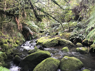
It wasn't long before we hit the Cumberland River, and it was like nothing we had ever seen.
I mentioned in one of the thousand videos I took that I felt like a T-Rex was about to pop out, we were in a different time, it felt prehistoric.
We now made our first of like a million river crossing for the weekend. The orange tags were calling us to continue, so forward we went.
Not far past the river crossing were stumbled on our first waterfall, the Allambee Falls, and we were all speechless with the beauty of where we were and what we were looking at.
The falls were beautiful so we took some time to just listen to the roar of the water crashing over the rocks and thinking how amazing it would be to go for a swim if it were warmer.
We reluctantly had to leave wondering what the next waterfalls have install for us as we were in a beautiful place. We felt so remote as the forest was so thick and all that pointed the way was the little orange tags on the trees.
We returned to our packs for a short rest and refuel before we headed back out along another little less overgrown track, again leaving our packs where they were.
Some of the biggest most amazing trees we had seen towered above us as we made our way down to Amphitheatre Falls and as always if she wasn't eating snacks, Kell was hugging trees.
With the Lerderderg Gorge being our playground, rocky and generally dry, we were amazed how green and wet the forest was in the Otways, simply stunning.
Yoga master Kev never misses a chance to do a downward facing dog while snapping a pic of some fancy coloured mushroom.
The river crossing started becoming more regular, back and forth snaking our way down stream but still managing to keep our boots dry.
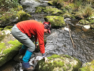
Kell using downward facing dog to attempt a river crossing, I think we have found her Achilles heal as the slippery rocks were messing with her head.
I wasn't long before we had arrived at our second set of waterfalls and like the first, our jaws dropped with the sheer beauty and power and noise of this amazing set of falls.
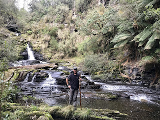
The Amphitheatre Falls were a set of cascading falls that stretched over a large area set in a remote part of the valley. Really pretty.
As always if we could explore, we did, slow and steady as the rocks were really slippery.
After a play in the playground for a good 45 minutes it was time to hit the road again. We decided not to back track but to try and pop out back onto Curtis Track.
We hit the track at the river crossing, great spot to camp, problem was our packs were 2km away up the track so off we went.
By 3:30 we had retrieved our packs and was back at the river. We crossed the river to a really nice grassy camp spot.
The river was the perfect place to soak our feet and freshen up before dinner, the normal rice and sausage topped with some port. Kev broke out the saki, the evening was full of a few laughs.
We woke to light rain but not enough to dampen our spirits. After some porridge we packed a day pack between us, few snack, first aid kit and a water bottle each. We decided to leave our packs in the tent as we would be returning later in the day and walking through this terrain would be extremely difficult.
Again the orange ribbons lead the way as the track was very hard to follow. River crossing after river crossing made the going slow
It wasn't long before we were at my fave falls of the hike, the Galliebarinda Falls.
They weren't the biggest or loudest, but there were something about these falls that drew we in. The location, the trees towering above, the beautiful swimming hole, everything about these falls made them spectacular.
The pics will never do this place justice but this will be a set of falls to visit in the summer to come spend some time at, even with the kids and even a picnic lunch.
This section was beautiful, the rain was steady but not annoying
We pushed on in the wet but pristine conditions continuously looking for a orange ribbon to path the way and leaping across logs, over the river and under dense shrubs.
After some serious scrambling we started heading out or the river towards Brunswick Falls, with reports these falls were the biggest and most spectacular in Victoria.
These falls were really hard to get to, no track and very few orange tags to guide us, we just had to strait line it bush bashing till we found it
Was dense, wet but pretty and our efforts paid off as we got closer we could hear a roar like no other that told us we were getting close to something big.
This thing was massive but very remote and really hard to get too. Kevs eagle ear could smell danger, it was a steep climb down and not a lot of room to even sit. Being wet and slippery made our stay here short as we wanted to start our way back up, this was as close as we could get. There was another track up top that we wanted to explore so we went and had a look.
We made our way along the track to the top of the Brunswick Falls, was easier going but couldn't really see how big they were from the top.
Some hikes we go on water is limited, we were never short on this hike, even Kell who normally struggles with drinking anything but Evian was happy to drink straight from the river.
From this point on trying to keep our feet dry was pointless and starting to get dangerous as the steady rain throughout the day was making the rocks really slippery.
From here we pretty much returned back the way we came snaking our way along and across the river. Kev was solid as a rock not letting the fast flowing water bother him but Kell who jumps out of planes and can run ultra marathons was finding the river crossings quite challenging.
Kev ended up becoming a walking smorgasbord for lots of leeches even having them crawl up his legs under his pants leaving blood spots everywhere.
We past Galliebarinda Falls on the way back before hitting the road and returning to our camp site.
Didn't take us long to pack up and make the 4km journey back to the car.
We had a great time and this hike was stunning. We missed Brent but spoke about returning again with him as there is still so much to see out here.
As always the company was the best, Wazzas Wanderers is a small little crew but we have some massive adventures, cant wait for the next one.


Track from tw spur meets the top of Brunswick Falls. Interested to know where the Galliebarinda trail leads from as that one I couldn't find. There are also more near Brunswick and Alambee Beek Falls to find.
ReplyDeleteBasically follows the river. Just head down Curtis track from sabine and when you get to the river cross it and head in to the ferns down stream after a few hundred metres it becomes more visible. I can't remember how I found it to begin with but have been back heaps over the years. Great walk, can do a circuit using the track off t.w spur but it's a long walk and can easily take wrong turn heading up to t.w from Brunswick falls or yanathan falls or viscera. Not a walk you want to do without being familiar with the area. The walk from amphitheatre to hidden falls is also fringin amazing.
ReplyDeleteThe track from Galliebarinda to Brunswick follows the Cumberland River. The track up to Yannathan/Upper Cumberland Falls and TW Spur is closer to the Brunswick Falls end.
ReplyDeleteThe track from the old Cumberland Station site to Hidden Falls has degraded in recent years. There has been a lot of erosion following the ORWTA ribbons down to Hidden, so much more traffic down there since it featured on the cover of Alan Carr's book (much respect to Alan Dow, Alan Carr and Wazza's Wanderers though). Bring a rope for Hidden Falls now.