Wednesday, October 3, 2012

Great Ocean Walk

Spring had sprung and it was time to polish up the boots and dust the cobwebs from the hiking gear as we were heading down to Cape Otway for a 3 day walk along a section of the famous Great Ocean Walk.
The plan was Cape Otway to Aire River, on to Johanna Beach and finish at Ryans Den.
Brent and I drove down from Ballarat on Sat morning and met up with Kev.
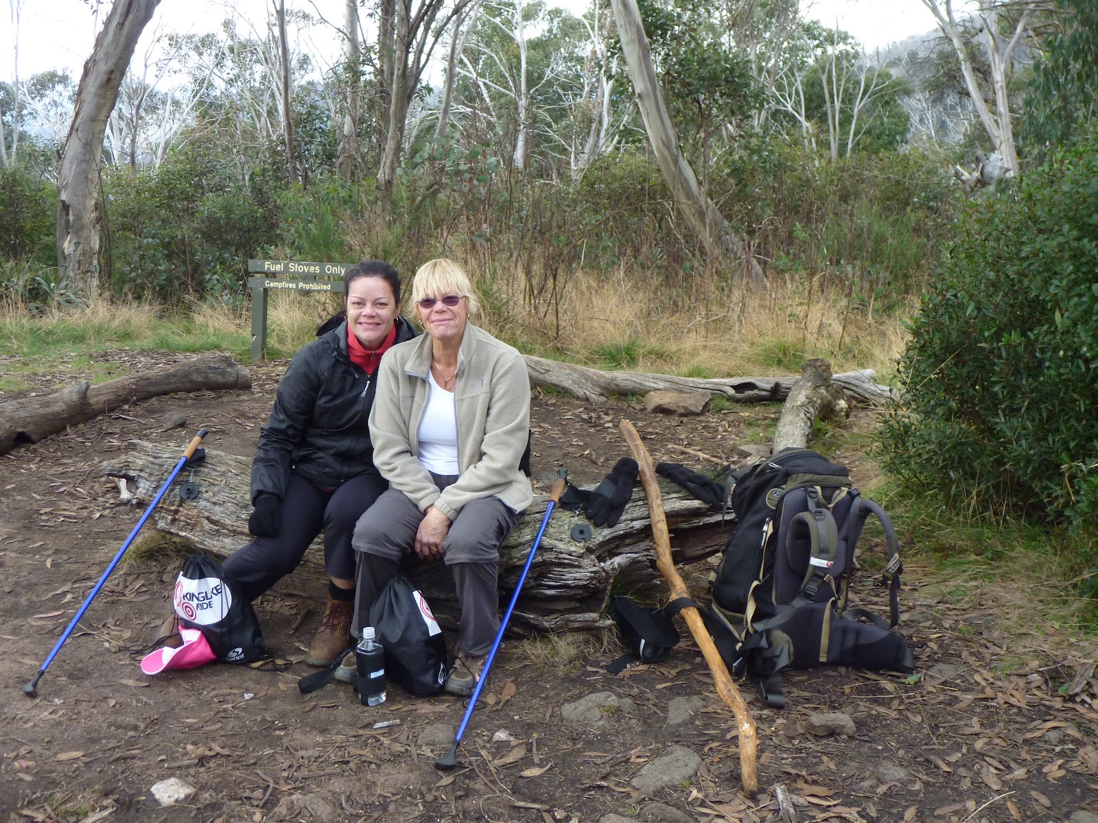
We parked the car at the light house at Cape Otway, geared up and began the 10km walk to Aire River. We left at 12.45pm.
 We had booked and paid for the permits to camp for the 2 nights prior to doing the walk.
The walk began on a narrow track that wound its way through coastal shrubs with glimpses of the ocean in the distance. The weather was overcast but it didn't take us long to warm up carrying 18kg packs on our backs.
As we got further into the walk we started to climb gradually and began to walk along the cliff tops that over looked Station Beach. If these were the views to come I couldn't wait to continue, they were amazing.
There was an option to continue along the cliff face or drop down onto Station Beach and have a look at Rainbow Falls. The beach option would take 30min longer. We decided to walk along the beach. It was very soft and hard going and there was heaps of rubbish washed ashore. We arrived at Rainbaow Falls and were very disappointed, it wasn't worth the effort so we continued and by 3pm we were of the beach and making our way toward Aire River.
By 3.30 we were above Aire River overlooking the camp site and taking in the great views. The walking so far except for the short section along the beach had been easy and we made good time. We reached the camp site by 4pm. Surprisingly there were quite a few families camping at the drive in section of the Aire River camp ground and as the arvo went on more and more people rocked up in their camper vans and caravans.
We had a look at the GOW walk in camp site that was about 100mt past the drive in camp ground but decided just to pitch the tents on some grass around a fire pit that was in the camp ground.

After some porridge and a coffee for breaky we packed up and took off at 9am the next morning. The first section was slightly up hill a bit but nothing too bad. The track was narrow but well defined and we saw the occasional wallaby scampering into the bushes.
At about 10.15 we had reached the beach and decided to de-pack and have a 15 minute breather. The beach was very secluded with large rocks scattered along the sand.
By 11am we had reached Castle Cove and again de-packed to have a look around the large cliff faces before making our way up to the drive in tourist lookout.
After Kev had a chat to a few Asian tourist in their lingo we continues on walking along the tops of the cliffs taking in the breathtaking views.
By midday we had reached a cool spot to have lunch, there was a bench with great views to the east looking back toward Cape Otway.
We left at 12.30 and headed for Johanna Beach, arriving on the sand by 1.20. The weather started to turn and the clouds were rolling in as we made our way along the beach towards the second camp site of the trip.
As we took our shoes off for the river crossing the rain began to fall. Once across the river that it wasn't much further along the Johanna Beach until we had reached the drive in camp site.
It was 2.30 pm, we said seeya to Kev as he had to work the next day, and we made our way to the Johanna Beach GOW Camp site, arriving there at 3pm.
This campsite was amazing, and if it wasn't for Dibbons Hut at Mt Hotham, this would have been the best I've camped at.
There was a shelter which we relaxed under while the light rain fell and we set our tents up atop of the cliff face overlooking Johanna beach. The view was amazing. We had walked over15km today
The night was cold but the sound of the waves was soothing, like rain on a tin roof. We wanted to head of early as we were meeting a taxi at midday near Ryans Den.
After some porridge and a coffee and an amazing sunrise, we were packed up and walking by 7.45.We had another 15km to walk today.
The first 4 km of today were through farmland on muddy 4wd tracks. The land was green, hilly and beautiful with kangaroos  hopping within meters of us. We made great time, reaching the Milanesia Track (4km)  by 8.50am. Now it was south toward the coast again, we hadn't seen the ocean all morning.
An hour later we were on Milanisia, there was a great grassy spot overlooking the ocean which was perfect for a break and some food. The last section down to the beach was quite steep. We had a 20min break then headed off along the beach. We noticed a really cool beach house situated in what seems to be the middle of nowhere, had a quick look then made our way along the beach.
The walk along the beach was short as the signs suggested we take the higher root as the beach root was closed.
The next 4km were the hardest of the trip. The track was well defined like the entire walk, but we were now walking up steep hills then back down them, continuously. The views of the coast line were great, we could see Cape Otway and the white spec on it which was the light house. It looked so far away and put what we had just done into perspective.
By 11.30 we were at the Ryans Den Track, it wasn't marked but was obvious. The last half an hour was up hill untill we reached Great Ocean Road. We rang The Great Ocean Walk Shuttle Service which picked us up and dropped us back Cape Otway, a 40min car ride. That service cost us $100.
This walk was very different to most we have done and I was not disappointing. Unfortunately for Kev the best part was day 3 from Johanna Beach to Ryans Den.
I can see in the future a return to continue from Ryans Den to the 12 Apostles.


Wednesday, May 16, 2012

The Bogong Challenge

May. 2012, the day had arrived when I was once again going to climb Victoria's highest mountain, Mt Bogong, This time was different to the others as I set my wife Tammy and her mum Lynne a challenge of getting fit enough to join me in a summit and return, in one day, via the Staircase.
We arrived at Mountain Creek picnic area at 7.30am, the morning was freezing but the sky was clear with the mountain looking amazing as we drove in.
We geared up and made our way along the 4WD track, crossing the river a number of times before reaching the start of the Staircase Spur at about 8.30.
A few layers come off as we started our way up the mountain. I think Tam and Lynne soon realised what I had got them into as the going was tough.
I was promising the girls a well deserved break when got to the hut, the half way mark of the staircase, but it was taking what seemed to be a life time to reach it with Tam and Lynne starting to hurt. 10.30 and Bivouac Hut was in sight, a well needed rest was in order. The weather was still great with some nice views starting to be seen through the trees. The hut was a great place for a break. 
After a 30min break we started off again, continuing our way up. I was surprised that the girls wanted to keep going as they were starting to get really sore. The ghostly snow gums were great to walk through as the track gradually  rose. We were now heading well a above 1500mt and the teperature dropped dramatically.  
Once we cleared the tree line at 1700mt the clouds rolled in and we started to get really cold.. The track started to flatten out and become very rocky and I started to feel confident that we would make it. Before long we couldn't see much at all and I was getting worried the Tam and Lynne would want to continue. 

After some convincing we pushed on into the clouds having a short rest at the memorial statue. The girls were done and I was trying to tell them that we didn't have far to go, but I had been saying that for a while so I don't think they believed me. Two hikers were on their way down and insured us that we were 20min from the summit and that it was clear up there so off we went. 

Half hour later we done it and arrived at the summit at1pm. We spent 30 min eating some lunch and taking in the great views. It was as if we had risen above the clouds because we had blue sky's and could see for miles. 

A group shot was in order and by 1.30 we were ready to start our decent. It always amazes me how much open space there is on top of Bogong and you don't really get the sense of height until you start making your way down. 

The clouds weren't as bad as the way up and we were getting some wonderful views to the north and especially the Eskdale Spur. Surprisingly Tam and Lynne were making good pace and it wasn't long  before we were at the memorial statue again. 

The next hour was the best for the views. We could see Michell Hut in the distance and mountains as far as the eye could see. It wasn't long and we were within the trees again making good time. It was still very cold and our knees started to ache with the down hill walking.  

By 2.45 we were back at Bivouac Hut for a 15min break. We were all starting to get a little sore and were looking to reaching the Bottom. After a snack and a drink we were off again for what I believe is the hardest part of the walk. 

It took almost 90min to reach the bottom of the Staircase as there were some very sore legs in the group. From here a pleasant 30 min walk back to the car.  
Today we traveled the 14km  in about 9.5 hours. The weather was amazing, it had a bit of everything from clear skies to heavy cloud and icy wind. It was a perfect day for walking. 
I didn't think Tammy and Lynne would make it to the top but I was very proud of them both, There were a few tears, a few laughs, a bit of anger and a lot of joy. 

That night as we were curled up in bed the weather turned nasty and we woke to a wet rainy day. I'm Glad we weren't climbing today. That afternoon, 24 hours after being on the summit,  the clouds cleared to an amazing view of Mt Bogong. Our timing was perfect.